ECDIS Meaning: What It Is and Why It Matters
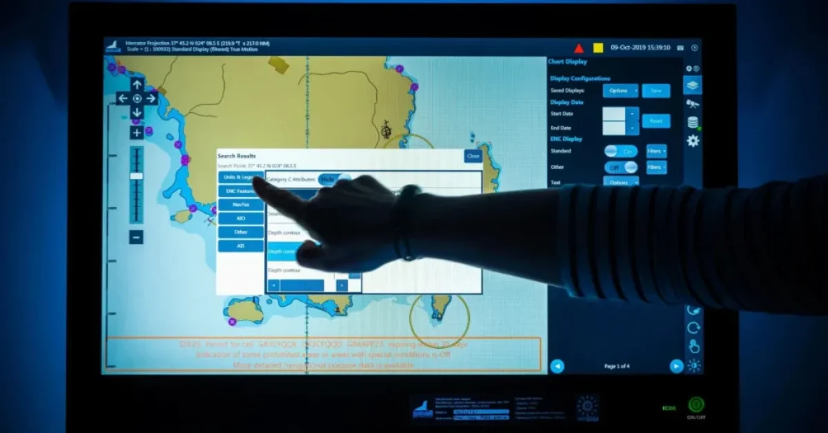
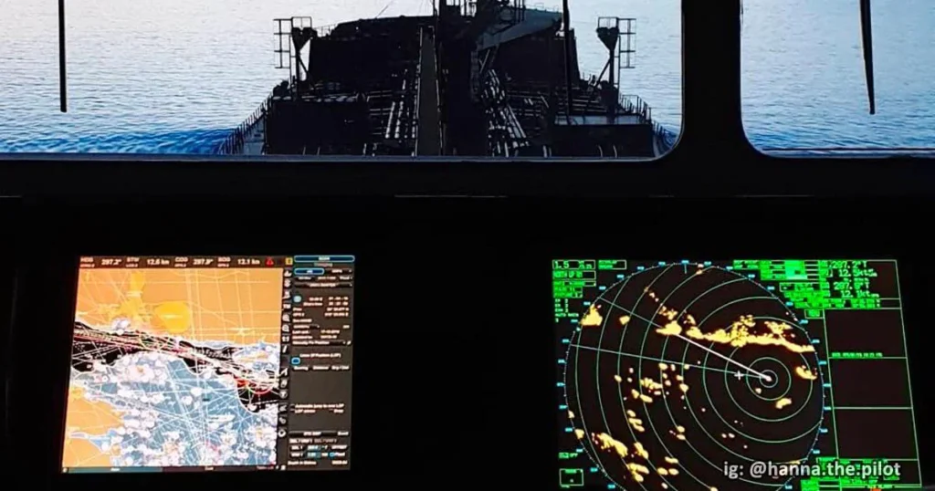
If you’ve ever heard the term ECDIS meaning and wondered what it stands for, it’s Electronic Chart Display and Information System. This system replaces old-fashioned paper charts with digital ones, making navigation smarter and safer. By using electronic navigational charts (ENCs) and real-time data from sensors, ECDIS helps ships stay on course, avoid hazards, and follow international regulations.
What Is a Nautical Chart?
A nautical chart is like a map for sailors. It shows important information about waterways, including depths, hazards, and landmarks, so ships can navigate safely. With ECDIS, these charts are now digital and interactive, providing even more precise data for safer navigation. Think of it as the digital version of a treasure map, but instead of looking for gold, it helps you avoid trouble on the water.
The Evolution of Navigational Charts: From Paper to Digital
For hundreds of years, sailors depended on traditional paper charts to navigate. While reliable, they had their downsides: they needed frequent updates, were bulky, and couldn’t show live information. Today, technology has brought us ECDIS, a tool that combines real-time information with advanced mapping. Just like GPS changed how we navigate on land, ECDIS has transformed maritime travel, ensuring navigational safety and making voyages easier and safer.
Key Features and Functions of ECDIS
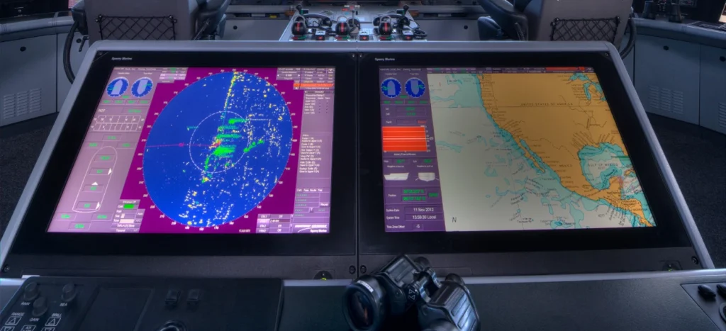
The Electronic Chart Display and Information System (ECDIS) is more than just a digital chart. It’s packed with features to make navigation better:
- Real-Time Information: ECDIS integrates data from navigation sensors, like GPS and radar, to show the exact location of the ship.
- Route Planning: Captains can map out their journey in advance and adjust the route easily if needed.
- Safety Alerts: The system warns about dangers such as shallow waters or restricted areas.
- Data Integration: ECDIS combines information from different sources, giving crews a complete picture of their surroundings.
What Does the International Maritime Organization (IMO) Say About ECDIS?
The International Maritime Organization (IMO), which sets global safety standards for shipping, requires certain ships to use ECDIS under the 1974 SOLAS Convention. According to Regulation V/19, vessels like passenger ships and cargo ships must use ECDIS to improve safety during international voyages. The IMO has also set performance standards for how ECDIS systems should work, ensuring consistency across the maritime industry.
What Are the Two Types of ECDIS?
ECDIS uses two types of digital charts:
- Electronic Navigational Charts (ENCs): These are highly detailed, interactive maps that are updated automatically to meet performance standards and regulations.
- Raster Navigational Charts (RNCs): These are digital images of paper charts. While they look familiar to traditional navigators, they lack the interactive features of ENCs.
Most ships use ENCs because they are more versatile and meet international chart requirements.
Do the Charts Get Updated?
Yes, one of the biggest advantages of ECDIS is that the electronic navigational charts (ENCs) are updated automatically. These updates ensure that the charts always show the latest information about depths, hazards, and other key details. In contrast, paper charts require manual updates, which can be time-consuming and prone to errors. This feature saves time and makes voyages safer.
What Are the 3 Mandatory Sensors of ECDIS?
To function properly, ECDIS relies on these three key sensors:
- Global Positioning System (GPS): For real-time location tracking.
- Gyrocompass: To display the ship’s heading.
- Speed Log: To measure the vessel’s speed through the water.
These sensors feed data into the ECDIS, ensuring it provides accurate and reliable navigational information.
Advantages of Using ECDIS Over Traditional Methods
Why are so many ships upgrading to ECDIS? Here’s what it brings to the table:
- Enhanced Safety: By showing real-time hazards and vessel positions, ECDIS improves safety during international voyages.
- Compliance with Rules: Many vessels, including passenger ships and cargo ships, must use ECDIS under Regulation V/19 of the 1974 SOLAS Convention.
- Efficiency: ECDIS reduces the time spent updating paper charts and recalculating routes.
- Environmental Benefits: Going digital reduces the need for paper, which is better for the planet.
What Ships Must Carry ECDIS?
According to ECDIS carriage requirements, the following ships must have ECDIS on board:
- Passenger ships of 500 gross tons or more.
- Cargo ships of 3,000 gross tons or more.
- Other vessels traveling on international routes, as required by the 1974 SOLAS Convention.
These rules ensure all large ships use tools that enhance navigational safety and efficiency.
What Are the 5 Alarms on ECDIS?
ECDIS has five critical alarms to alert the crew about potential issues:
- Positioning Alarm: Warns if the GPS signal is lost or unreliable.
- Cross-Track Error Alarm: Alerts when the ship deviates too far from the planned route.
- Shallow Water Alarm: Indicates that the vessel is approaching shallow areas.
- Collision Alarm: Warns about possible collisions with other ships or objects.
- System Failure Alarm: Notifies the crew of hardware or software malfunctions.
These alarms help crews act quickly to avoid accidents.
What Is the Difference Between Alarm and Warning on ECDIS?
In ECDIS, alarms and warnings serve different purposes:
- Alarms: These are critical and demand immediate action. For example, an alarm may sound if the ship is at risk of running aground.
- Warnings: These are less urgent and provide advisory information. For instance, a warning might suggest checking the route for possible updates.
Understanding these alerts ensures the crew can prioritize their responses effectively.
What Other Acronyms Do I Need to Know?
When working with ECDIS, you might come across several other acronyms. Here are a few important ones:
- GPS (Global Positioning System): Tracks the ship’s location.
- AIS (Automatic Identification System): Helps identify nearby vessels.
- ENC (Electronic Navigational Chart): The primary chart format used in ECDIS.
- SOLAS (Safety of Life at Sea): An international treaty for maritime safety.
These terms are often used alongside ECDIS, so understanding them is key.
Challenges and Considerations in ECDIS Implementation
Switching to ECDIS isn’t always smooth. Here are some challenges:
- Training: Crews must learn to use ECDIS correctly, as misinterpretation can lead to mistakes.
- Cost: Installing and maintaining ECDIS can be expensive for smaller operators.
- Backup Requirements: Ships must still carry paper charts as a backup in case the ECDIS system fails.
The Future of ECDIS and Digital Navigation
Technology in maritime navigation is constantly evolving. Future versions of ECDIS may include AI-driven features for automated route optimization or predictive weather analysis. These upgrades will likely make voyages even safer and more fuel-efficient, keeping ECDIS at the core of the maritime industry’s future.
Conclusion
The ECDIS meaning goes beyond just “Electronic Chart Display and Information System.” It represents a leap forward in how ships navigate safely and efficiently. From its reliance on electronic navigational charts (ENCs) to its ability to provide real-time information, ECDIS has become essential for modern shipping. Whether it’s ensuring compliance with ECDIS carriage requirements or enhancing navigational safety, this technology is paving the way for the future of maritime travel.
Also Read This: What Is Voyage Management System?
